
Numerous large river basins worldwide have limited observations of the components of the terrestrial hydrological cycle with the exception of a few stream gauges along with sparsely distributed rain gauges. Using satellite observations and output from global land surface models, it is possible to study these under-observed river basins. With populations greater than a billion people, some of these rivers (e.g., the Ganga-Brahmaputra, the Yangtze, the Nile and the Mekong) are the economic engines of the regions they transect, yet thorough assessment of their flow dynamics and variability in regard to water resource management is still lacking. We performed a thorough analysis of the variability of individual water balance components. Better understanding the inter-annual and intra-seasonal variability and the spatial variability of the water balance components in the major river basins of the world will help to plan for improved management of water resources for the future.
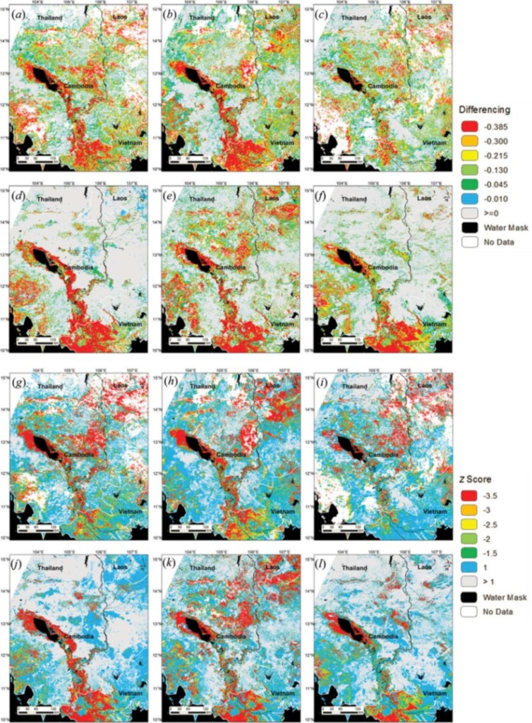
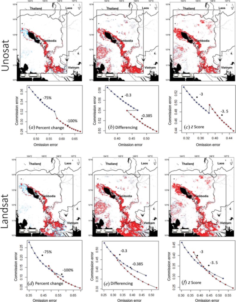
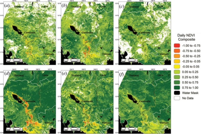
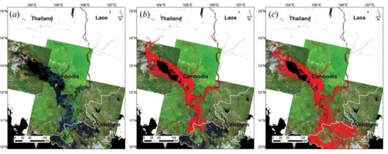
Due to the flat, low-elevation terrain in parts of Cambodia and Vietnam, the monsoon season brings significant and consistent flooding between May and November in areas surrounding the Mekong Delta. To monitor flooding in this region, we developed a near real-time flood extent product (FEP) using seasonal normalized difference vegetation index (NDVI) differences from the 250 m resolution Moderate Resolution Imaging Spectroradiometer (MODIS) sensor compared to daily observations.
