Jessica V. Fayne
Remote Sensing Hydrometeorologist Radar Hydrologist and Metrologist
JFayne [at] umich [dot] edu
Welcome!
Hello there! Thank you for visiting my website!
The important changes that we are observing in the form of Arctic permafrost melt, increased regional flooding and droughts, wildfires,and landslides are all indicative of changes in local hydrology. The methods I develop harness information from field and remote sensing datasets to monitor and produce an improved understanding of hydrologic changes that are restructuring the hydrosphere.
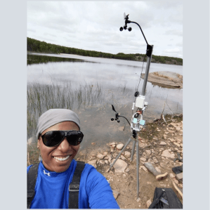
I am an Assistant Professor at the University of Michigan in the Department of Earth and Environmental Sciences. I am a hydrologist and remote sensing scientist; I study water availability dynamics as a result of local scale natural and anthropogenic land cover/land use change and global-scale climate change. To conduct these studies, new datasets and observations need to be made. From the algorithm development side, I use satellite and airborne remote sensing observations to extract estimates of diverse hydrological and hydrometerological parameters such as water surface extent, water elevations, over-water wind speeds, soil moisture and vegetation water.
I use remote sensing tools and datasets to study water features such as water quantity (elevations and volumes) and state (solid vs liquid phase, surface dynamics: roughness/turbulence). My research is extremely interdisciplinary, crossing fields of electrical engineering (radar science), civil engineering (hydrology), urban planning (land use), and geography (spatial analytics). I am interested in studying surface water from rivers and lakes as well as subsurface soil moisture and aquifers. By understanding the dynamics of water quantity and state, we can better understand current and historical hydrologic trends and improve resilience to ongoing climatic changes.
Affiliations
I earned my Ph.D. from the University of California, Los Angeles from the Department of Geography in May 2022. During my Ph.D., I was a visiting student researcher at the NASA-Jet Propulsion Laboratory in Pasadena, California, and I was also a member of the Northern Change Research Lab, in the Department of Earth, Environmental and Planetary Sciences (DEEPS) at Brown University.
After completing my Ph.D., I completed a 7-month postdoctoral research position at the University of Southern California in the Department of Computer Science and Electrical Engineering.
Research Areas
High-frequency radar surface scattering
Water balance for terrestrial water storage
Downscaling precipitation, soil moisture, and temperature for improved water balance estimates
Flood mapping and prediction
Landslide mapping and prediction
Wildfire susceptibility
Experience
Visiting Researcher, NASA Jet Propulsion Laboratory, Radar Engineering
(September 2017 – Present)
- Worked with the AirSWOT Processing Group to produce interferometrically-derived elevation models and converted the AirSWOT elevation models into GIS-accessible multi-band GeoTIFFs.
- Worked with radar and hydrology research groups at JPL to analyze AirSWOT scattering and phenomenology data to in support of the upcoming SWOT mission and future Ka-band instruments
Intern, NASA Goddard Space Flight Center, Terrestrial Information Systems
(June 2017 – August 2017)
- Mapped ice abundance and melt pond change using historical Landsat data across the Arctic Beaufort and Chukchi Seas
Research Associate, University of Maryland, Baltimore County, Joint Center for Earth Systems Technology (JCET) + Applied Remote Sensing Training (ARSET)
(November 2016 – September 2017)
- Analyzed precipitation measurements from ocean buoy rain gauges.
- Examined noise characteristics and compared in situ buoy and satellite data from TRMM and GPM
- Led in-person remote sensing training introducing satellite precipitation datasets and digital elevation models
Research Associate, University of South Carolina, School of the Earth, Ocean and Environment
(May 2015 – May 2017)
- To produce high spatial- and temporal- resolution water storage maps of a dozen major river basins around the world, I (1) Studied soil moisture, precipitation, and vegetation to determine changes in terrestrial water storage and (2) Developed a method to improve forecasting methods to determine fluctuations in subsurface freshwater
- Led in-person remote sensing training introducing satellite precipitation (TRMM/GPM), terrestrial water storage (GRACE), and optical remote sensing datasets (Landsat/MODIS) and supported external projects through data analysis and training
